
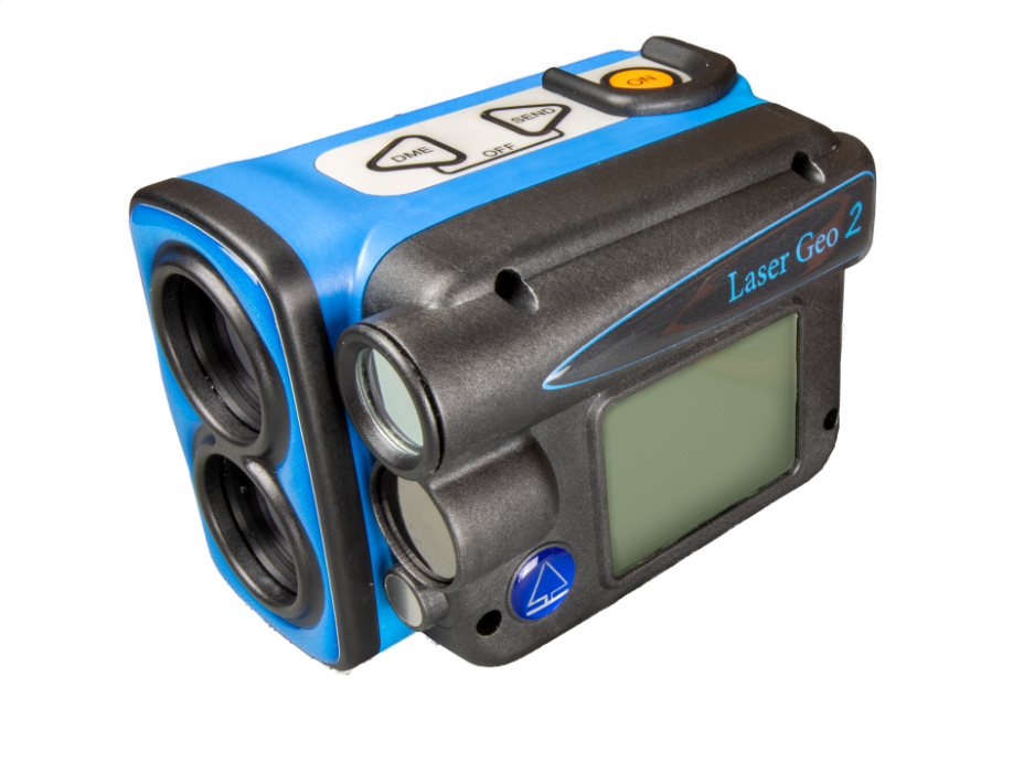
HAGLOF Laser Geo 2 ເຄື່ອງວັດລະດັບໄລເຊີມື (0-999 m/ft)
Size: 93x63x72mm/3.7×2.5×2.8”
Weight: 243 g/8.6oz.
Battery and consumption
Rechargeable Li-Ion 3.7V, built-in, approx. 2000 measurements. Charging time max 3.5h.
USB mini B interface wall charger 110/220AC/5VDC; car charger adapter 12VDC. Cable Usb mini B Male/Usb Type A Male, 0.5m.
Consumption max 0.9W.
Communication
IR, USB 2.0/SSD Disk.
Dual-mode Bluetooth BR/EDR.
Bluetooth low energy V4.2 (LE) and Classic connectivity.
Spp (serial profile), pin code 1234.
Temperature: -20° to +45° C/ -4°F-113°F.
Height: 0-999 m/ft. Resolution height: 0.1 m/ft.
Angle: -90° – 90°. Unit: Degrees 360⁰, Grads 400⁰ and %. Resolution: 0.1⁰. Accuracy: 0.1⁰ typical.
LASER
Distance: 46cm/1.5ft – 700m/2000ft depending on target. Accuracy: 4cm/0.1ft typical.
Resolution: 0.1m/ft (0.01m/0.1ft in DME-mode).
Areal
0<area<5000m2 or 0.5ha<area<10000ha
0<area<20000f2 or 0.5acre<area<10000acre
Remote diameter
Sight range: 0-46 positions
Max diameter: 47” at 39ft / 98cm at 10m
Resolution: 0.1”/ 0.1cm
Accuracy : 0.5” at 39ft / 1.2cm at 10m
GPS
33-channel high sensitivity receiver. Supports GPS, Glonass, Galileo, QZSS. Built-in real tme correction w SBAS (EGNOS, WAAS, MSAS, GAGAN)
Accuracy down to 2.5m/8.19ft in open terrain. Satellite position prediction for up to 3 days.
Host Based multi-global navigation satellite system GPS(USA)/GLONASS(Russia)/Galileo(EU)/QZSS(JAPAN) SBAS Satellite-based augmentation systems: WAAS(US) EGNOS(EU) GAGAN (India) MSAS(Japan). Built-in self-generated orbit prediction (Faster TTFF up to 3 days), built-in jamming removing. Accuracy: Automatic position 2.5m CEP (circular error probable) (50% 24 hr static, -130dBm.
Speed 0.1m/s (50%@30m/s.
Compass: Azimuth compass 0-360˚, resolution 0,1˚, accuracy <1.5 RSME˚.
Classification: MIL-STD-810E. Housing frame material glass filled poly carbonate, IP67, NEMA6, Laser class 1, 7mm (FDA, CFR21) Class 1m (IEC 60825-1:2001).
Sight: Dot aim 1 x magnification and (HUD) Head-up-display.
Display: External Graphic LCD 100x60pixles. Internal (HUD) Head-up-display.
Dataformat: Nmea or Ascii. IR, Bluetooth.
File Format: CSV and KML (Google Earth).
Memory: 2000 datasets, non-volatile.
Other information
Adapter and monopod staff, 4-parts (33-140cm)
Aluminum transport/storing case. See user manual for more details.
ຮັບສ່ວນຫຼຸດພິເສດຕາມປະລິມານ, ອັບເດດລາຄາຂາຍສົ່ງ ແລະ ການແຈ້ງເຕືອນສິນຄ້າໃໝ່ສົ່ງກົງເຖິງອິນບັອກຂອງທ່ານ.
ໂດຍການສະໝັກສະມາຊິກ, ທ່ານຍອມຮັບ ເງື່ອນໄຂການໃຫ້ບໍລິການ ແລະ ນະໂຍບາຍຄວາມເປັນສ່ວນຕົວ ຂອງພວກເຮົາ.
ເຂົ້າເຖິງຜູ້ຊ່ຽວຊານທີ່ໄດ້ຮັບການຢັ້ງຢືນຂອງພວກເຮົາໂດຍກົງ